A visually compelling new book by Pilar Maria Guerrieri, prosaically titled Maps of Delhi (Niyogi Books), studies

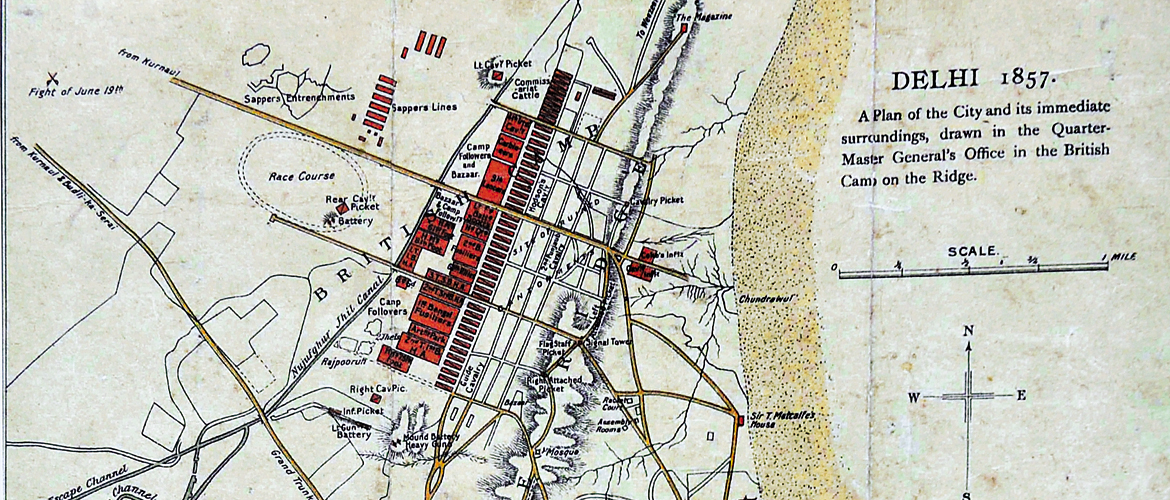
The title suggests, according to the book, that the map served a very specific purpose—representing the locations of barracks, infantry, cavalry, artillery batteries, and picket locations of the British military during the mutiny of 1857. In this respect, it might have been a guide for the counter-attack strategy. Besides the fact that the map was produced in 1857, a crossed-swords symbol on the top-left marks the “fight of June 19th”, which refers to the start of the mutiny. The book points out that the colours used on the map, too, hold military relevance—red indicates British camps, brown, the Mughal city, yellow, principal routes, and blue, rivers and canals.
We’ve read aplenty about the 1857 mutiny from the Indian side but it is a revelation to see an artefact made by the British to counter the mutiny. It’s been nearly 160 years since the battles, yet this part of history does not fail to stir our collective consciousness.
Delhi
history
India